Geographic Information Systems Asked on December 8, 2020
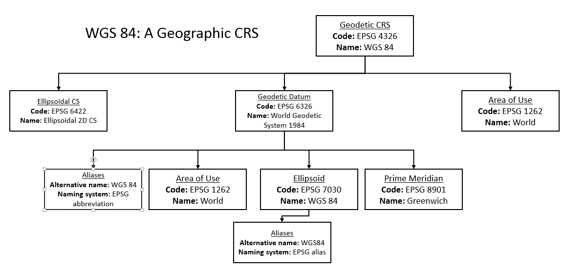
I’ll go straight to the point; I remember long ago that I was quite shocked the first time I discovered that EPSG:4326 was kind of an "umbrella" definition on top of many others, which often stay hidden unless you specifically need them (which is almost never the case except if you are a geodesist).
Is there a tool to visually represent and explore all the underlying EPSG resources, their relationships and the structure binding them, which altogether make up any of the most well-known CRS, such as the ESPG:4326?
The result I’m looking for should look like what you see in this picture: https://tomroth.com.au/epsg/Capture-12.png
Some kind of visual equivalent for the great tool projinfo.
It’s for pedagogic purposes.
Get help from others!
Recent Answers
Recent Questions
© 2024 TransWikia.com. All rights reserved. Sites we Love: PCI Database, UKBizDB, Menu Kuliner, Sharing RPP