What is the scale of the map of Rokugan?
Role-playing Games Asked by CatLord on December 29, 2021
Is anyone aware of the scale of the map for L5R? They talk about the sorts of tribulations of travel, but not what sorts of travel times are to be expected for any range and inquiring minds (my table) want to know.
My table has sent a message to an Emerald Magistrate to address an immediate high severity crime and want to know how long it should take for it to get there. They have also been in situations involving timing a mercantile barge, or making it to a specific location by a given moon phase.
2 Answers
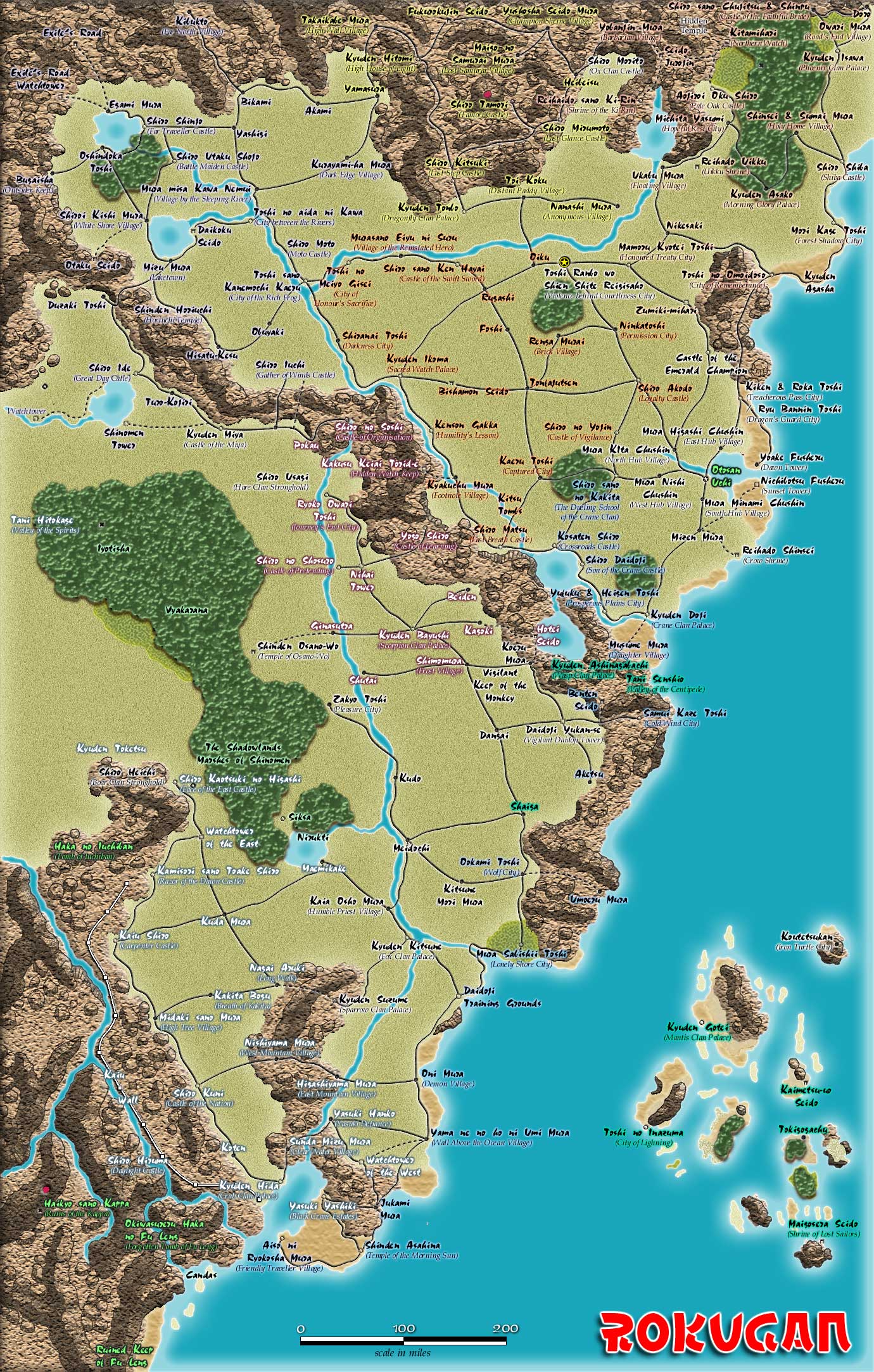
ISTR d20 Rokugan has a scale bar on the map.
The following image looks to be the same
 From: http://brennor.dyndns.org/~steve/L5R/CombatMaps/map_rokugan.jpg
Answered by aramis on December 29, 2021
The problem with the printed maps is that they are Imperial statements and cannot be wrong. If the ground disagrees with the maps then the ground is wrong. How dare it defy the Empress? Of course, if you're late because you thought the map was right, then you're the one at fault.
There is one distance reference that I can find in the write-up of Toshi no Inazuma that states that the Island of Silk and Spice it is on is about 45 miles long. This is the west-most of the Mantis islands.
Using it, we can take a guess that CN10 to 18 are about the same 45 miles apart. And from there, you should be able to determine a physical scale with a ruler.
Assuming the Imperial Cartographers are right about the distance between Toshi no Inazuma and Dojo Raiden that is.
Answered by Simon Gill on December 29, 2021
Add your own answers!
Ask a Question
Get help from others!
Recent Answers
- Lex on Does Google Analytics track 404 page responses as valid page views?
- haakon.io on Why fry rice before boiling?
- Joshua Engel on Why fry rice before boiling?
- Jon Church on Why fry rice before boiling?
- Peter Machado on Why fry rice before boiling?
Recent Questions
- How can I transform graph image into a tikzpicture LaTeX code?
- How Do I Get The Ifruit App Off Of Gta 5 / Grand Theft Auto 5
- Iv’e designed a space elevator using a series of lasers. do you know anybody i could submit the designs too that could manufacture the concept and put it to use
- Need help finding a book. Female OP protagonist, magic
- Why is the WWF pending games (“Your turn”) area replaced w/ a column of “Bonus & Reward”gift boxes?